

Building out Chattanooga | UTC Professor featured by NASA
The story highlights Hossain’s use of Landsat, an Earth-observing satellite program that documents surface changes over time.
Being featured by NASA is a big deal, but having a decade of work published by the organization is an even bigger deal.
That happens to be the case for Dr. Azad Hossain, an environmental geoscientist and associate professor in the University of Tennessee at Chattanooga (UTC) Department of Biology, Geology, and Environmental Science, who was recently featured as NASA Earth Observatory’s “Image of the Day.”
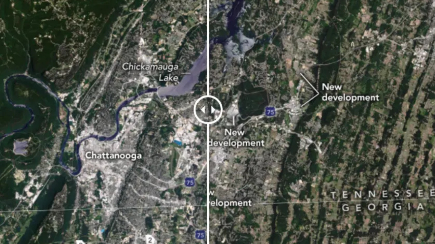
The article details the growth of Chattanooga’s landscape over time through the use of satellite images taken over two decades. From 2021, Hossain’s laboratory captured images to show how much the city has grown. They did this through the use of Landsat, an Earth-observing satellite software.
Hossain has used Landsat data since the late 1990s. A lot has changed since then.
“It took more than two months to get an image,” he told UTC Communications. “Now, if I tell you we need to get a Landsat scene for Chattanooga, after one hour, I can show you the image.”
He said another reason for NASA’s interest in the research was Chattanooga’s recent designation as North America’s first National Park City.
“Chattanooga is a unique place. If you look for urbanization, you’ll find it here,” he said.
Hossain joined UTC in 2016. He saw a need for research on local urbanization. With help from students and colleagues, he began using satellite data to track development.
“It’s not only for me,” he said of the NASA recognition. “It’s the work I did, but it’s also my students’ work. When I got this article published, I was in class and I told my students, ‘Look, this is public. You can go there and see it.’ I feel pretty good. I’m sure they also feel good.”
To learn more about Hossain’s research and other UTC stories, visit UTC News.
Like what you've read?
Forward to a friend!