

Simplifly is prepping to unveil ‘Drone in a Box’ services
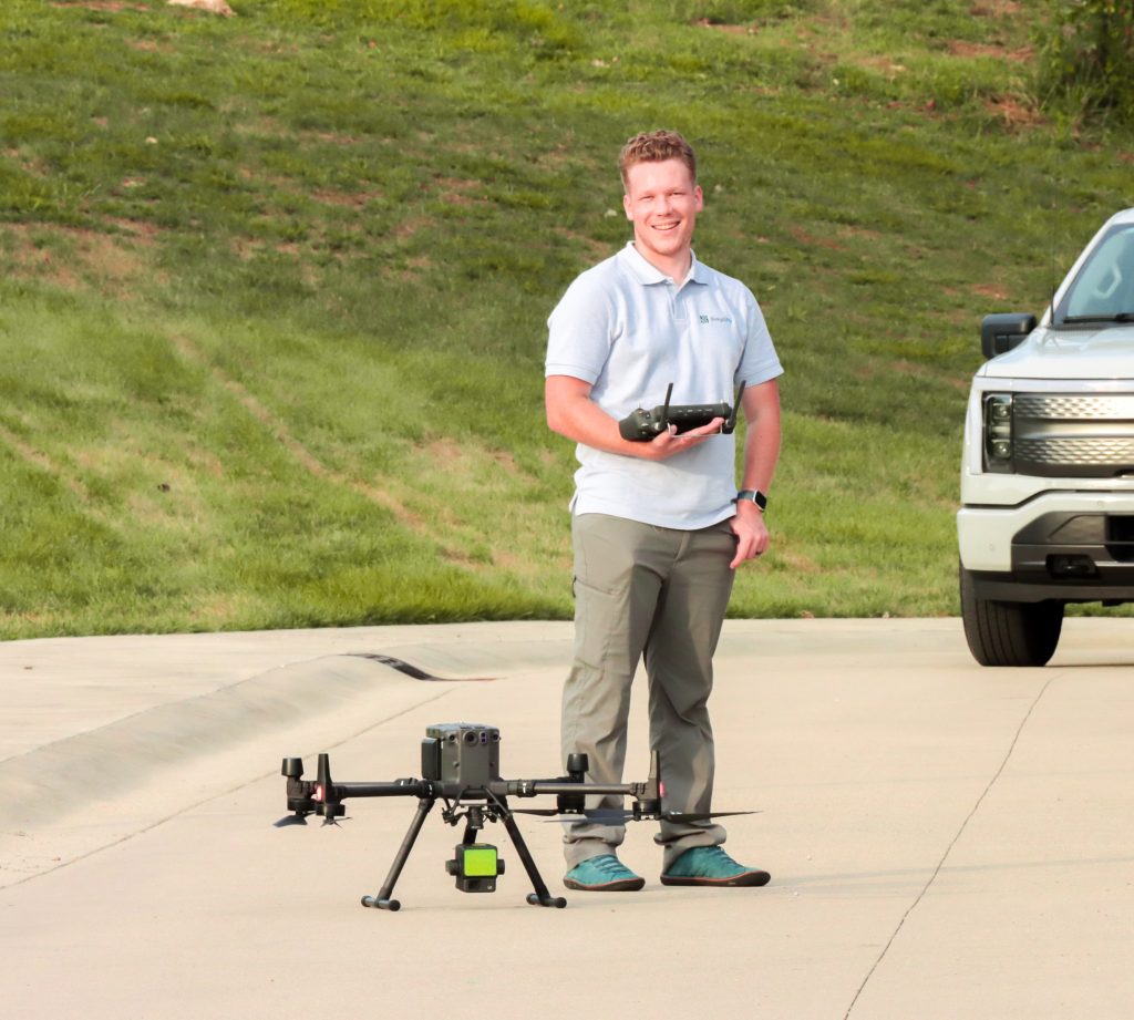
Brenton Roesner has established operations across the United States, serving golf courses, construction sites, energy projects, and land surveys. Now, he hopes to bring the business back home to East Tennessee.
Imagine if you could order a drone to your doorstep, just like ordering an Uber. It would make household tasks like clearing the gutters, checking your roof, and obtaining aerial topography shots of your property much simpler.
That’s the future Brenton Roesner dreams about. For the past year, he’s been working for his company, Simplifly’s ‘Drone in a Box’ product offering, and now he’s just waiting for regulations to swing in the drone industry’s favor.
“I look forward to what could happen this year with new laws and regulations. If things go well, hopefully we can make Knoxville a city where you may see as many drones flying in the sky as you would airplanes,” Roesner said.
Roesner’s innovation of a ‘Drone in a Box’ is something he’s been working on behind the scenes for a while. His goal is to have a platform where people can get online, order a time slot, and have a drone arrive at the doorstep within a few minutes. Roesner said the system is fully automatic, which allows customers to gather data they need to track patterns, uphold compliance standards, and monitor their sites.
“You can’t force people to use new technology, but you can show them value by solving problems,” he said. “That’s what we plan to do.”
It also solves one of Roesner’s biggest hurdles for scaling his business – there’s only one of him. Meaning, he can only be in one place at a time. Plus, repeat visits day after day, or week after week, are costly for the customer.
Read more about Simplifly’s services.
Knoxville area entrepreneur is bringing aerial data expertise home
Originally published December 4, 2025.
Nearly every kid thinks drones are cool, but very few turn that fascination into a full-time career. Brenton Roesner did, and he built an aerial data business that has taken him to 48 states and five countries.
It all started in Clinton, Tennessee, where Roesner grew up. Homeschooled through high school, he watched both of his parents navigate running their own businesses. That upbringing taught him something important: passion can become purpose-driven work.
After graduating, Roesner landed a year-long apprenticeship with SkySite in Knoxville. There, he learned how to program and fly drones.
It was his introduction to surveying and aerial imaging technologies as a career.
“It confirmed for me that I really liked drones. My entrepreneurial journey looked like me trying to turn that passion into a job,” he said.
Turning Drones and Data into a Career
In 2020, Roesner made the bold decision to strike out on his own as a freelance contractor for aerial inspections, 3D imaging, topography, and map creation. He called the company SimpliFly and initially targeted industries such as construction, golf course management, energy, and property inspection.
“Talk about a tough time to start a business,” he said. “COVID really threw a wrench in things.”
The golf industry, however, remained strong. Forbes reported that the sport experienced an unprecedented boom in new players during the pandemic. In fact, 2020 saw more rounds of golf played at courses across the United States than at any time in history.
Roesner saw an opportunity.
There are more than 15,000 golf courses in the U.S. and more than 30,000 worldwide. Plus, the growing golf simulator industry requires real courses to be scanned for digital play.
“I love the golf industry. Every single course is unique and different. No two projects are the same,” he said. “I knew it was going to be a good fit.”
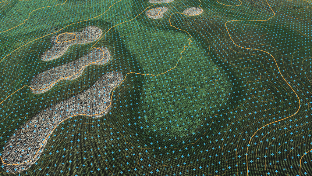
Through referrals, his workload began to skyrocket. Today, Roesner offers technologies such as topography services (elevation), volumetrics, orthomosaic imaging for georeferenced aerial maps, lidar, and thermal imaging.
Over the last five years, he has traveled across the globe mapping more than 72,000 acres of golf courses, construction sites, property inspection, and energy projects.
Growing a Customer Base at Home
Now, Roesner is ready for a change of pace, one that keeps him closer to home.
A small portion of his data collection business is already in Tennessee, but he wants to live in East Tennessee permanently to be near family and build local operations.
“Knoxville is the best combination of all the best parts of all the places I’ve been,” he said, admitting a bit of hometown bias.
Like what you've read?
Forward to a friend!