

Vanderbilt University moving forward with innovation district plans
The goal is to reshape 40 underutilized acres on the campus’s western edge into a mixed-use, pedestrian-first hub for research, collaboration, and entrepreneurship.
As we first reported (click here for details) during a session at LSTCON, the annual conference of Life Science Tennessee, Vanderbilt University has announced that it is filing a Specific Plan (SP) application with the Nashville Planning Department to reshape 40 underutilized acres on the campus’s western edge into a mixed-use, pedestrian-first hub for research, collaboration, and entrepreneurship.
The goals of this long-term initiative are to more quickly translate university research into real-world solutions, strengthen cross-sector partnerships, and expand opportunities for students, alumni, and faculty by putting Nashville and Tennessee at the forefront of the innovation economy of the future.
Vanderbilt’s plan, developed through extensive consultation with neighbors and community stakeholders, prioritizes walkability, safety, connectivity, public spaces, and thoughtful traffic management in alignment with university and community values.
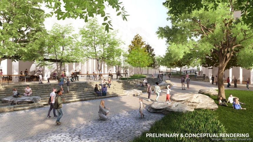
The SP establishes a framework for development of the neighborhood. It lays out a plan for streets and pedestrian networks, green space, and general building height and density, as well as for ground-level amenities and public spaces. The framework, which is adaptable to market conditions, community needs, and the surrounding site context, kicks off the next phase of engagement with stakeholders and partners.
After submission, the Nashville Planning Department will consider the proposal and provide opportunities for members of the community to offer feedback. Over several months, Vanderbilt, the community, and the planning department will work together to determine next steps and what will be the final framework for the neighborhood’s development.
Vanderbilt has drawn up plans for a vibrant, mixed-use neighborhood that connects the campus to the city. Office and lab space will be next to retail, restaurants, and new housing, all stitched together with green space. Height and density will be rebalanced to prioritize public space and walkability by shifting taller buildings away from residential edges and toward the West End corridor. Planned mobility upgrades include an enhanced street network that helps pedestrians, bicyclists, and cars move more safely and efficiently, dedicated walking and biking paths, safer crossings, and capacity for future traffic.
Like what you've read?
Forward to a friend!